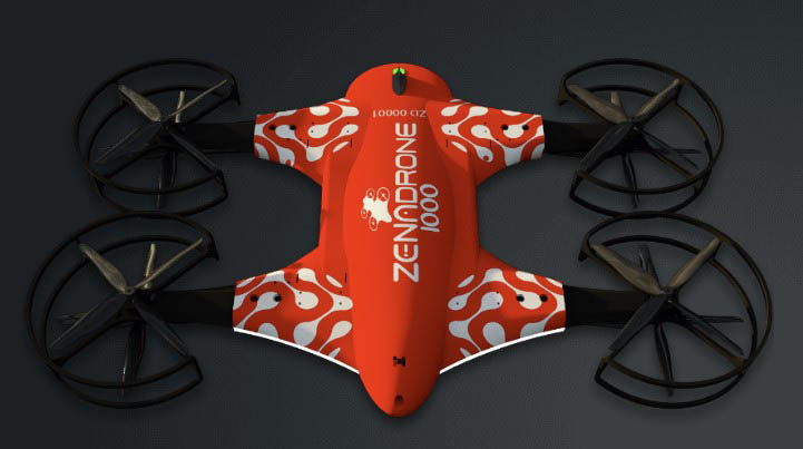
Drones Are the New First Responders

By Dr. Shaun Passley

In terms of sheer versatility, it’s hard to imagine an invention that surpasses the unmanned aerial vehicle–aka UAV or simply, “drone.” Drone technology provides nearly endless practical uses across a wide swath of industries. Drones are used to launch missiles, photograph both homes and war zones and deliver pizzas. They can streamline inspection and monitoring processes, save field technicians from hazardous work, reduce workforce and operational costs, automate and perform tasks efficiently, and complete tasks that may be difficult or impossible for humans to do.
While the commercial drone industry is still in its infancy, UAV manufacturing companies are racing to prove themselves in a number of critical missions in order to keep us safe from a wide array of threats. And yes, they are winning.
Crime Prevention and Simulation
Top of mind for many urban Americans these days is the soaring crime rate. Cities are becoming more population dense and structurally complex, posing unprecedented challenges for law enforcement. Keeping large and dynamic places safe requires comprehensive planning, which requires detailed and timely information. However, collecting such data is both costly and time-consuming for officers. It’s also intrusive, at a time when police departments are aiming for a lighter touch due to liability and sensitivity issues.
Thankfully, police drones have proven themselves over decades. Like helicopters, they are an eye in the sky, but at a fraction of the cost and visibility. Police regularly use drones to sweep areas of jurisdiction more efficiently than would be possible using land vehicles, foot patrols or helicopters.
Likewise, securing a location from threats like terrorists or armed criminals traditionally entails innovative counter-surveillance technology and uses a lot of resources. With drones, however, police can gather, monitor and inspect information on operational assets from a safe distance–and without deploying significant human capital. Advanced drones can also capture sharp photos and record HD videos that allow law enforcement to assess unfolding events on the ground–in real time–and review them later.
One reason that drones are so efficient is that they require only one operator but can be fitted with multiple sensors, scanners and HD (or 4K) cameras. And because many crimes happen at night, law enforcement drones can be equipped with thermal scanners that register body heat signatures, providing clear footage even in the dark. For criminals and terrorists, there’s literally nowhere to hide.
Search and Rescue
But what happens when the bad guy is nature? Saving lives in the fog of a natural disaster is challenging in the best conditions and nearly impossible in the worst. Help can never arrive fast enough, but without a bird’s-eye view of the situation, rescuers are often risking their lives to little effect. Whether due to storm damage, aftershocks, and/or debris, locating lost or injured people on the ground can be difficult and may take hours or days. Worse, the longer the rescue process, the more lives are at risk and the lower the chances of success.
Drones, however, can track movement and locate critical objects much faster than a search party. Indeed, advanced drones now use multispectral sensors and thermal scanners to find people in virtually any environment or weather. These features can help find missing persons or animals in remote places like mountains, collapsed buildings, forests, thick brush and other challenging environments. Using drones rather than manned aircraft–or simply manpower–can easily mean the difference between life and death.
Moreover, with real-time imagery, responders can get accurate data with which to plan rescues efficiently from a safe distance. The same multispectral sensors can register wind velocity, humidity, weather, and model climate shifts as they happen. They can also detect possible aftershocks and tsunamis, so rescuers can direct people in the storm zone to vacate critical areas, saving life and property in the process.
Mapping Disaster Zones
Best of all, an advanced drone can render 3D models of terrain and fields, making search and rescue faster and easier in rural environments also. And because smaller drones can take off and land vertically, they can get to almost any location. Unlike manned aerial vehicles, for example, UAVs can survey the unreachable and dangerous zones with very few exceptions. Most importantly, surveyors don’t need to go to these often dangerous places themselves in order to get the information they need.
When the disaster is spread out over a large geographical area, as with the tornadoes that savaged Kentucky earlier this year, an autonomous drone can be deployed to map terrain and set the drone’s flight route. Then responders can examine the whole area to determine the best course of action–recognizing weak points, and familiarizing any evacuation routes needed when a future disaster occurs. Special drones made of durable materials and equipped with extended life batteries can endure the harshest weather conditions for far longer than human beings. So rather than coming in blind, emergency personnel can approach each disaster zone in the most efficient manner and with the most appropriate resources–a huge morale booster.
Of course, we will never stop using the term “first responders” to describe the brave individuals who risk their lives to rescue others in the midst of natural (or man-made) disasters. But advanced drones have become a critical tool for both predicting and assessing any event in which life and property are at risk.
In addition to being the Founder of ZenaTech, which owns the ZenaDrone technology, Dr. Passley is also the Founder of EPAZZ, Inc. and seven other companies.